Home > Europe > United Kingdom > England > Herefordshire > Ledbury > Robert Browning
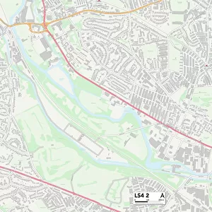
Leeds LS9 6 Map

![]()
Wall Art and Photo Gifts from Map Marketing
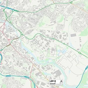
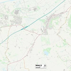
Leeds LS9 6 Map
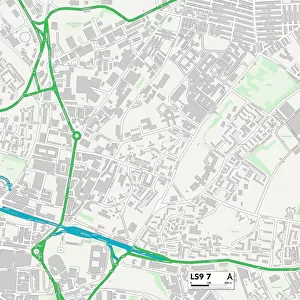
Postcode Sector Map of Leeds LS9 6
Media ID 19974802
Beech Crescent Beech Lane Beech Walk Broughton Avenue Buller Close Clifton Avenue Clifton Grove Clifton Terrace Compton Road Cowper Road Hudson Road Hudson Street Juniper Place Kimberley Road Kitchener Street Leeds Oak Tree Close Oak Tree Drive Oaklands Drive Oaklands Grove Roberts Avenue Roberts Court Seaforth Road Strathmore Avenue Sutherland Road
FEATURES IN THESE COLLECTIONS
> Arts
> Artists
> B
> William Brown
> Arts
> Artists
> H
> Robert Hills
> Europe
> United Kingdom
> England
> Herefordshire
> Ledbury
> Robert Browning
> Europe
> United Kingdom
> Scotland
> Sutherland
> Europe
> United Kingdom
> Wales
> Flintshire
> Broughton
> Europe
> United Kingdom
> Wales
> Powys
> Brecon
> Map Marketing
> Postcode Sector Maps
> LS - Leeds
> Maps and Charts
> Related Images
MADE IN THE USA
Safe Shipping with 30 Day Money Back Guarantee
FREE PERSONALISATION*
We are proud to offer a range of customisation features including Personalised Captions, Color Filters and Picture Zoom Tools
SECURE PAYMENTS
We happily accept a wide range of payment options so you can pay for the things you need in the way that is most convenient for you
* Options may vary by product and licensing agreement. Zoomed Pictures can be adjusted in the Cart.