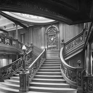
Home > Europe > United Kingdom > England > London > Sights > Victoria Park
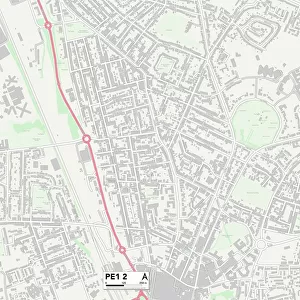
Peterborough PE1 2 Map

![]()
Wall Art and Photo Gifts from Map Marketing
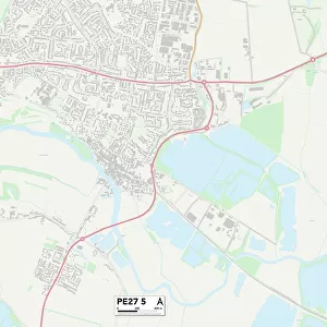
Peterborough PE1 2 Map
Postcode Sector Map of Peterborough PE1 2
Media ID 19977076
All Saints Road Beech Avenue Bright Street Broadway Burghley Road Cambridge Avenue Clarence Road Cobden Avenue Cobden Street Craig Street Cromwell Road Dyson Close English Street Fitzwilliam Street Gladstone Street Granville Street Harris Street Henry Street Lime Tree Avenue Link Road Norfolk Street North Street Nursery Close Occupation Road Park Road Parliament Street Peppercorn Close Peterborough Princes Street Queens Gardens Russell Street Springfield Road St Marks Street Summerfield Road Townsend Close Victoria Place Windmill Street Deacon Street
FEATURES IN THESE COLLECTIONS
> Animals
> Mammals
> Muridae
> House Mouse
> Arts
> Artists
> B
> Henry Bright
> Arts
> Artists
> C
> Craig Craig
> Arts
> Artists
> H
> Henry Harris
> Arts
> Portraits
> Pop art gallery
> Street art portraits
> Europe
> United Kingdom
> England
> London
> Sights
> Victoria Park
> Europe
> United Kingdom
> England
> Norfolk
> Bradfield
> Europe
> United Kingdom
> England
> Norfolk
> Related Images
> Europe
> United Kingdom
> England
> Norfolk
> Summerfield
> Europe
> United Kingdom
> Scotland
> Aberdeenshire
> Huntly
> Map Marketing
> Postcode Sector Maps
> PE - Peterborough
MADE IN THE USA
Safe Shipping with 30 Day Money Back Guarantee
FREE PERSONALISATION*
We are proud to offer a range of customisation features including Personalised Captions, Color Filters and Picture Zoom Tools
SECURE PAYMENTS
We happily accept a wide range of payment options so you can pay for the things you need in the way that is most convenient for you
* Options may vary by product and licensing agreement. Zoomed Pictures can be adjusted in the Cart.